Saturday, 28 February 2015

MY COLLECTION - ALBUM NO 8 - WEST ASIA - SYRIA, TURKEY AND JORDAN COINS


CHAPPIDI ABHIRATH REDDY
C/O COL GKS REDDY

Secunderabad - 500015


Syria Currency


         The Syrian pound (sign: LS or £S; Arabic: الليرة السورية al-līra as-sūriyya, French: livre syrienne; ISO code: SYP) is the currency ofSyria and is issued by the Central Bank of Syria. The pound is subdivided into 100 qirsh (Arabic: قرش plural: قروش, qorush, piastres inEnglish or French), although coins in qirsh are no longer issued.


         Before 1947, the word qirsh was spelled with the initial Arabic letter غ, after which the word began with ق. Until 1958, banknotes were issued with Arabic on the obverse and French on the reverse. After 1958, English has been used on the reverses, hence the three different names for this currency. Coins used both Arabic and French until Syrian independence, then only Arabic.

          The standard abbreviation for the Syrian pound is SYP. On 5 December 2005, the selling rate quoted by the Commercial Bank of Syria was 58.4 SYP to the US dollar. A rate of about 50 pounds to one dollar has been usual in the early 2000s, but the exchange rate is subject to fluctuations. Since the start of the Syrian civil war against the president Bashar Al Assad in 2011, the exchange rate of the Syrian pound has deteriorated quickly from 47 SYP for US$1 in March 2011 to over 200 SYP for US$1 in June 2013. Hard currencies such as the USD, CAD, GBP or Euro cannot be bought from banks or exchange companies; the black market is the only source of foreign currencies available to Syrian businessmen, students and those who want to travel abroad. The maximum amount that is allowed to be taken out with the Syrian traveler is US$3,000 per flight per year. Any amount in excess of US$3,000 is confiscated by the authorities and the Syrian traveler will risk spending a long time in what is called "economic affairs court". The Syrian pound is not a hard currency, and there are restrictions on its export (the maximum amount is 2,500 SYP per person).


History


         During the period when Syria was a part of Ottoman Empire - which lasted about 400 years - the Ottoman lira was the currency. Following the fall of the Ottoman Empire and the placing of Syria under a mandate (French Occupation), the Egyptian pound was used in the territories under French and British mandates, including Lebanon, Transjordan andPalestine. Upon taking Lebanon and Syria under its separate mandate, the French government sought to replace the Egyptian currency and granted a commercial bank, the Banque de Syrie (a French affiliate of the Ottoman Bank), the authority to issue a currency for states under its new mandate.

         The pound (or livre as it was then known) was introduced in 1919 and was pegged at a value of 20 French francs[citation needed]. As the political status of Lebanon evolved, the Banque de Syrie, which was to act as the official bank for Lebanon and Syria, was renamed the Banque de Syrie et du Grand-Liban (BSL). The BSL issued the Lebanese-Syrian currency for 15 years, starting in 1924. Two years before the expiration of the 15-year period, the BSL split the Lebanese-Syrian currency into two separate currencies that could still be used interchangeably in either state. In 1939, the bank was renamed the Banque de Syrie et du Liban.

          In 1941, the peg to the French franc was replaced by a peg to the British pound of 8.83125 Syrian pounds = 1 British pound, as a consequence of the occupation of Syria by British and Free French forces. This rate was based on the pre-war conversion rate between the franc and sterling. In 1946, following devaluation of the franc, the Syrian pound was pegged once again to the franc at a rate of 1 pound = 54.35 francs. In 1947, the U.S. dollar was adopted as the peg for the Syrian currency, with 2.19148 pounds = 1 dollar, a rate which was maintained until 1961. The Lebanese and Syrian currencies split in 1948. From 1961, a series of official exchange rates were in operation, alongside a parallel, black market rate which reflected the true market rate for Syrian pounds in Jordan and Lebanon where there was a healthy trade in the Syrian currency. The market was allowed to flourish because everybody, including government and public sector companies, needed it. The black market rate diverged dramatically from the official rate in the 1980s. 


My Collection of Syrian Coins


25 Piastres – Syria - Nickel - 1979


Fifty Piastres – Syria - Nickel - 1979


One Pound – Syria - FAO – Nickel - 1968


One Pound – Syria - Nickel - 1979


One Pound – Syria - Small - Nickel - 1991


Two Pounds – Syria - Ancient Ruins - 1996


Five Pounds – Syria - Old Fort - 2003


Ten Pounds -  Syria - Ancient Ruins - 2003


Turkey Currency


         The Turkish lira (Currency sign: / ; Turkish: Türk lirası) is the currency of Turkey and the Turkish Republic of Northern Cyprus(recognised only by Turkey). The Turkish lira is subdivided into 100 kuruş.


History


Ottoman Lira (1844 - 1923)


       After the last vestige of the ancient Roman Empire collapsed with the Fall of Constantinople to the Ottomans, today's Turkish State Mint was founded by Mehmed II. The first golden coin was minted in the name of "The Conqueror" in 1467.

          The Ottoman lira was introduced as the main unit of currency in 1844, with the former currency, kuruş, remaining as a 1/100 subdivision. The Ottoman lira remained in circulation until the end of 1927.


First Turkish Lira (1923 - 2005)


         Historical banknotes from the second, third and fourth issues have portraits of İsmet İnönü on the obverse side. This change was done according to the 12 January 1926 issue of the official gazette and canceled by the Democrat Party after World War II.


Second Turkish Lira (2005 - Till Date)


          In December 2003, the Grand National Assembly of Turkey passed a law that allowed for redenomination by the removal of six zeros from the Turkish lira, and the creation of a new currency. It was introduced on 1 January 2005, replacing the previous Turkish lira (which remained valid in circulation until the end of 2005) at a rate of 1 second Turkish lira (ISO 4217 code "TRY") = 1,000,000 first Turkish lira (ISO 4217 code "TRL"). With the revaluation of the Turkish lira, the Romanian leu (also revalued in July 2005) briefly became the world's least-valued currency unit. At the same time, the Government introduced two new banknotes called TRY100 and TRY50. One EU diplomat has stated that Turkey will adopt the Euro if it joins the European Union.

         In the transition period between January 2005 and December 2008, the second Turkish lira was officially called Yeni Türk Lirası (New Turkish lira). It was officially abbreviated "YTL" and subdivided into 100 new kuruş (yeni kuruş). Starting in January 2009, the "new" marking was removed from the second Turkish lira, its official name becoming just "Turkish lira" again, abbreviated "TL".

          All obverse sides of current banknotes and reverse sides of current coins have portraits of Mustafa Kemal Atatürk.


My Collection of Turkish Coins


One Kurush – Turkey - Nickel - AH 1293 AD 1876


Ten Para – Turkey - Copper - AH 1293, AD 1876


Ten Kurus – Turkey - Nickel - 1956


Ten Bin Lira – Turkey - Nickel - 1995


1000 Lira – Turkey - Nickel - 1990
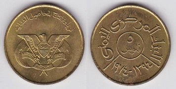


Jordan Currency.


          The dinar (Arabic: دينار, ISO 4217 code JOD; unofficially known as JD) is the currency of Jordan. The dinar is divided into 10 dirham, 100 qirsh (also called piastres) or 1000 fulus.

         The Jordanian dinar continued to be used in the West Bank along with Israeli currency after Israel took control of it in 1967. During Israel's hyperinflation in the 1970s and 1980s, the Jordanian currency provided stability.


History


          From 1927 to 1950, the Palestine Currency Board issued Palestine pound as the official currency in both Palestine and the Trans-Jordan Emirate. After Jordan became an independent kingdom on 25 May 1946, the idea of issuing a national currency arose and led to the passing of the Provisional Act No. 35 of 1949. Under this Act, the Jordan Currency Board was formed, which became the sole authority entitled to issue Jordanian currency in the kingdom. The London-based entity consisted of a president and four members. As of 1 July 1950, the Jordanian dinar became the kingdom’s official currency, and use of the Palestinian pound ceased in the kingdom on 30 September 1950. Although issued by the Jordan Currency Board, the notes bear the name of The Hashemite Kingdom of the Jordan.

Until 1992, coins were denominated in Arabic using fils, qirsh, dirham and dinar but in English only in fils and dinar. Since 1992, the fils and dirham are no longer used in the Arabic denominations and the English denominations are given in dinar and either qirsh or piastres.


My Collection of Jordanian Coins. I have only one coin of Jordan in the Album, as on today.


25 Fils - Jordan - Cupro Nickel - 1977


Note - Some of the images of coins in my collection, have been taken from the Gallery to the extent available, to save on time & effort involved in photography & editing.

Saturday, 14 February 2015

MY COLLECTION - ALBUM NO 8 - WEST ASIA - UAE, REPUBLIC OF YEMEN & YEMEN ARAB REPUBLIC COINS


CHAPPIDI ABHIRATH REDDY,g
C/O COL GKS REDDY,


Secunderabad - 500 015.


UAE Currency


       The dirham (Arabic: درهم‎) (sign: د.إ; code: AED) is the currency of the United Arab Emirates. The ISO 4217 code (currency abbreviation) for the United Arab Emirates dirham is AED. Unofficial abbreviations include DH or Dhs. The dirham is subdivided into 100 fils (فلس).


History


          The name Dirham derives from the Greek word Drachmae, literally meaning "handful", through Latin. Due to centuries of old trade and usage of the currency, dirham survived through the Ottoman regime.

         The United Arab Emirates dirham was introduced 19 May 1973. It replaced the Qatar and Dubai riyal at par. The Qatar and Dubai riyal had circulated since 1966 in all of the emirates except Abu Dhabi, where the dirham replaced the Bahraini dinar at 1 dirham = 0.1 dinar. Before 1966, all the emirates that were to form the UAE used the Gulf rupee. As in Qatar, the emirates briefly adopted the Saudi riyal during the transition from the Gulf rupee to the Qatar and Dubai riyal.


My Collection of UAE Coins


Five Fils – UAE - Copper - 1996


Ten Fils – UAE - Large - Copper - 1973


Ten Fils – UAE - Small – Copper - 1996


25 Fils  - UAE - Steel - 1995


50 Fils – UAE - Large – Nickel - 1989


50 Fils – UAE - Small – Septagonal – Steel - 1995


One Dirham – UAE - Large – Nickel - 1989


One Dirham – UAE - Small – Nickel - 1995


One Dirham – UAE - small – Steel - 2005


Yemen Currency.


          The rial or riyal is the currency of Yemen. It is technically divided into 100 fils, although coins denominated in fils have not been issued since Yemeni unification.


History


        After the union between the North (the Yemen Arab Republic) and the South (the People's Democratic Republic of Yemen) in 1990, both the northern rial and the southern dinar remained legal tender during a transitional period, with 1 dinar exchanged for 26 rials. On 11 June 1996, the dinar was withdrawn from circulation. In 1993, the first coins were issued for the Republic of Yemen. The value of rial against the United States dollar has dropped significantly compared to 12.01 rials per dollar in early 1990s. Since the mid-1990s the Yemeni rial has been freely convertible. Though it has dropped from YER 20 to approximately YER 215 against the U.S. dollar since then, the rial has been stable for several years. However, since 2010 the Central Bank had to intervene several times, resulting in a serious decline of foreign reserves. By late 2013, the Economic Intelligence Unit expects reserves to decline to approximately 1.3 months of imports over the following years, despite information that Saudi Arabia would transfer $1 billion to the Yemeni Central Bank.


My Collection of Yemen Arab Republic Coins


Ten Fils – Yemen Arab Republic - Brass - 1974


25 Fils – Yemen Arab Republic - Cupro Nickel - 1974


Fifty Fils – Yemen Arab Republic - Cupro Nickel - 1985


One Riyal – Yemen Arab Republic - Cupro Nickel - 1978


My Collection of Republic of Yemwn Coins


Five Riyals – Republic of Yemen - Steel - 1993


Ten Riyals – Republic of Yemen - Steel - 1995


Twenty Riyals – Republic of Yemen - Steel - 2006


Note - Some of the images of coins in my collection, have been taken from the Gallery to the extent available, to save on time & effort involved in photography & editing.

Thursday, 29 January 2015

VISIT TO EUROPE - CROATIA - DUBROVNIK - OLD TOWN - III - CITY WALLS AND FORTS


CHAPPIDI ABHIRATH REDDY,
C/O COL GKS REDDY,


Secunderabad - 500 015.


Visit to Dubrovnik old Town (09 & 10 May 2014)


Dubrovnik Old Town


          The 'Pearl of the Adriatic', on the Dalmatian coast, was an important Mediterranean sea power from the 13th century onwards. Although severely damaged by an earthquake in 1667, Dubrovnik managed to preserve its beautiful Gothic, Renaissance and Baroque churches, monasteries, palaces and fountains.

          Dubrovnik was founded in the first half of the 7th century by a group of refugees from Epidaurum, who established their settlement at the island and named it Laus. The Latin name Ragusa (Rausa), in use until the 15th century, originated from the rock (Lat. lausa = rock). Opposite that location, at the foot of Srđ Mountain, the Slavs developed their own settlement under the name of Dubrovnik, derived from the Croatian word dubrava, which means oak woods. When the channel that separated these two settlements was filled in the 12th century they were united. From the time of its establishment the town was under the protection of the Byzantine Empire; after the Fourth Crusade the city came under the sovereignty of Venice (1205-1358), and by the Treaty of Zadar in 1358 it became part of the Hungarian-Croatian Kingdom, when it was effectively a republican free state that reached its peak in the 15th and 16th centuries. An economic crisis in Mediterranean shipping and, more particularly, a catastrophic earthquake on April 1667 that levelled most of the public buildings, destroyed the well-being of the Republic. This powerful earthquake came as a turning point in the city's development.


          Dubrovnik is a remarkably well-preserved example of a late-medieval walled city, with a regular street layout. Among the outstanding medieval, Renaissance and Baroque monuments within the magnificent fortifications and the monumental gates to the city are the Town Hall (now the Rector's Palace), dating from the 11th century; the Franciscan Monastery (completed in the 14th century, but now largely Baroque in appearance) with its imposing church; the extensive Dominican Monastery; the cathedral (rebuilt after the 1667 earthquake); the customs house (Sponza), the eclectic appearance of which reveals the fact that it is the work of several hands over many years; and a number of other Baroque churches, such as that of St Blaise (patron saint of the city).

          The original World Heritage site consisted solely of the defences and the intra-mural city. It was later extended to include the Pile medieval industrial suburb, a planned development of the 15th century, and the Lovrijenac Fortress, located on a cliff, which was probably begun as early as the 11th century, but owes its present appearance to the 15th and 16th centuries. Also included were the Lazarets, built in the early 17th century to house potential plague-carriers from abroad, the late 15th-century Kase moles, built to protect the port against south-easterly gales, and the Revelin Fortress, dating from 1449, which was built to command the town moat on its northern side.

         The island of Lokrum lies to the south-east of Dubrovnik, some 500 m from the coast. In 1023 it became a Benedictine abbey, the first of several in the Republic of Dubrovnik. It was continually enlarged in succeeding centuries, passing to the Congregation of St Justina of Padua in the late 15th century, when a new monastery was built in Gothic-Renaissance style to the south of the ruins of the Benedictine establishment. During their occupation of the island in the early 19th century the French began work on the construction of the Fort Royal Fortress, which was completed by the Austrians in the 1830s. In 1859 Archduke Maximilian of Austria (later Emperor of Mexico) bought the island with the intention of building a villa in classical style on the ruins of the Benedictine abbey, but only a small part of this work was completed.


Historical Description


          The proposed extension to the west of the old city includes part of the Pile suburb, with the Brsalje plateau. It marks the point where a major road entered the Roman town that preceded medieval Dubrovnik, and archaeological excavations have revealed the presence there of a Palaeochristian basilica, as well as medieval cemeteries. The Lovrijenac Fortress, located on a cliff, is first mentioned in a document of 1301, but its defensive importance is such that it must have been built much earlier (as early as the 11th century according to some scholars). The fortress owes its present appearance to the 15th and 16th centuries.

          The Pile suburb was a planned development of the 15th century, around a clearly defined industrial zone dating back to the 13th century. It was devoted to tanning and leather-working, the casting of cannon, soap manufacture,etc - activities which, for reasons of hygiene and security, were placed outside the walls but within the protection of the fortress. In the early 15th century an important dyeing industry developed in the area, and this was followed by other industries, such as glass-making, bell-casting, and weaving.

          These industrial operations led to the construction of workers' houses, and the settlement had its own Church of St George, dating back to the 14th century but rebuilt in its present form in 1590. The Pile suburb has retained its original character, although some changes resulted from the building in the late 19th century of a new road linking Pile with Gruz and passing outside the ramparts of the medieval town. The area known as Iza Grada (Behind the city) lies outside the northern part of the ramparts, and has remained an open space, for defensive reasons, throughout the town I s history. The road joining Pile and Gruz marks its northern boundary.

          On the eastern side of the old city lies Ploce, which has served as the centre for trade with the hinterland for centuries. The area proposed for the extension of the World Heritage Site lies to the south of the main road and includes the Lazarets and the Revelin Fortress.

         The Kase moles were built around 1485 on the plans of paskoje Milicevic, the most famous Ragusan engineer of the Renaissance period, to protect the port against south-easterly gales while at the same time improving the facilities for controlling vessels approaching the town.

          The building of the Lazarets began in 1627 and they were completed in 1648. Their siting at the eastern entrance to the city was practical: this is where traders and travellers would approach Dubrovnik from potentially plague-ridden parts of central Europe or the Orient. They have preserved their original appearance to a remarkable degree.

        The Revelin Fortress, built to command the town moat on its northern side, dates from 1449, though its present appearance is that of the 16th century, when it was remodeled by the architect Antonio Ferramolino di Bergamo.

          The island of Lokrum lies to the south-east of Dubrovnik, some 500 m from the coast. In 1023 it became a Benedictine abbey, the first of several in the Republic of Dubrovnik. The monastic complex (and especially the Church of the Virgin Mary, destroyed by the earthquake of 1667 and not rebuilt) was continually enlarged in succeeding centuries. Following the reform of the Benedictine Order in the later 15th century, the monastery passed to the Congregation of St Justina of Padua, which was responsible for the building of a new monastery in Gothic-Renaissance style to the south of the ruins of the Benedictine establishment.

          During their occupation of the island in the early 19th century the French began work on the construction of the Fort Royal Fortress, which was completed by the Austrians in the 1830s. In 1859 Archduke Maximilian of Austria (later Emperor of Mexico) bought the island with the intention of building a villa in classical style on the ruins of the Benedictine abbey, but only a small part of this work was completed.


City Walls and Forts (Contd)


 The Dubrovnik city walls are the major attraction for visitors and one of the best preserved fortification complexes in Europe. The 1940-metre long walls encompass five forts and sixteen towers and bastions. The worlds second most attractive museum in the open air, the walls are open for visitors all the year round. The three entrances to the walls include those next to St Lukes Church in the east, next to St Saviours Church at the Pile entrance to the Old City and next to the Maritime Museum located at St Johns Fort. 

          Taking a walk along the Dubrovnik city walls you will see some of the striking forts used for the defence of the Dubrovnik Republic. Of the five existing forts, Minčeta, Bokar and St John were built within the city walls complex, whereas the two freestanding ones include Lovrjenac in the west and Revelin in the east. Located at the highest point of the city Fort Minčeta protected Dubrovnik from the north. The fort is the symbol of Dubrovniks defence and the flag of Croatia waves on it all the time.


Detached Forts


          There are a total of Four detached Forts / Fortifications around the city, two in the vicinity on the East and West of the city and one each on Srd Hill in the North and Lokrum Island on the South East.


Fort Ravelin


          In the period of unmistakable Turkish danger and the fall of Bosnia under Turkish rule, a detached fortress providing additional protection to the land approach to the eastern Ploče Gate was built to the east of the city in 1462. The name Revelin derives from rivelino (ravelin), a term in military architecture which refers to work built opposite the city gate in order to afford better protection from enemy attack. Danger of Venetian assault suddenly increased in the times of the First Holy League, and it was necessary to strengthen this vulnerable point of the city fortifications. The Senate hired Antonio Ferramolino, an experienced builder of fortresses in the service of the Spanish admiral Doria, a trusted friend of the Republic. In 1538 the Senate approved his drawings of the new, much stronger Revelin Fortress. It took 11 years to build it, and during that time all other construction work in the city had stopped in order to finish this fortress as soon as possible.


          The new Revelin became the strongest of the city fortresses, safeguarding the eastern land approach to the city. Shaped in the form of an irregular quadrilateral with one of its sides descending towards the sea, it is protected by a deep ditch on the other. One bridge crosses the protective ditch and connects it to the Ploče Gate, while another bridge connects it to the eastern suburb. The construction work was executed so perfectly so that the devastating earthquake of 1667 did not damage Revelin. Divided into three large vaulted rooms in its interior, Revelin became the administrative center of the Republic.


A view of Ravelin Fort From the Walls


Another view of Ravelin Fort 


A view of Ravelin Fort from just outside the City Walls 
(From between the City Walls and the Fort)


A view of Ravelin Fort from the Bridge connecting the City walls and the Fort


A view of Fort Revalin from the Road outside Northern City wall


Ploce Gate - East of the City


A view of the Ploce Gate from inside (The wall on the Left is the Ravelin Fort)


A view of the Ploce Gate (Outer Gate) from the Bridge connecting to
                              the Road. The Ravelin Fort is to the left. Thus Ravelin Fort is 
                              located between the Inner and outer entries of the Ploce Gate


A view of Outer Entry of Ploce Gate and the Ravelin Fort to the Right


St Lawrence Fort


         St. Lawrence Fortress (Croatian: Lovrijenac), often called Dubrovnik's Gibraltar, is located outside the western city walls, 37 metres (121 ft) above sea level. The fortress has a quadrilateral court with mighty arches and, as its height is uneven, it has 3 terraces with powerful parapets with the broadest one looking south towards the sea. Lovrijenac was defended with 10 large cannons, being the largest and most famous called "Lizard" (Croatian: Gušter). The walls exposed to enemy fire are almost 12 meters (39 feet) thick, but the large wall surface facing the city does not exceed 60 centimetres (2 feet). Two drawbridges lead to the fort, there being the inscription "Non Bene Pro Toto Libertas Venditur Auro" – "Freedom is not to be sold for all the treasures in the world." above the gate. To ensure loyalty, the troops in St. Lawrence Fortress were rotated every 30 days. And to ensure complete loyalty, they were given only 30 days of rations when they went into the fort. According to old scripts it was built in only three months.

          Today its interior is one of the most dignified stages in Europe, and a well-known place for William Shakespeare's Hamlet performances.


A view of Fort St Lawrence (Lovrijenac) outside the western City Walls


Another view of Fort Lovrijenac


A long shot of Fort Lovrijenac with the new City Landscape 
in the Foreground and Adriatic Sea beyond


Fort Imperial


          The Fortress is placed at the top of the mountain Srđ, just above the city of Dubrovnik. It was built in 1806 by Marshal Marmont, called the Imperial, in honor of emperor Napoleon. The fortress was strategically important to defend the northern side of the city.


A view of Fort Imperial, located on Top of Srd Mountain to the North of the Walled City


A view of Fort Imperial on the skyline from the Rectors Palace 


A view of Fort Imperial with the City Landscape in the Foreground


The Lokrum Island


          Lokrum (pronounced [lɔ̌krum], Italian: Lacroma) is an island in the Adriatic Sea 600 metres (1,969 feet) from the city of Dubrovnik,Croatia. It stretches from northwest to southeast and receives regular ferry service from the city.


          Austrian archduke (and short-lived Emperor of Mexico) Maximilian once had a holiday home on the island. A monastery and abotanical garden survive from his era. On the island's highest point at 96 metres (315 feet) above sea level stands Fort Royal Castle, which was built by the French, though it was later named "Maximilian's Tower" by the Austrians.


A view of Lokrum Island from the Fort Wall


A closeup of Lokrum Island, located to the SE of Dubrovnik. Fort Royal 
located on the highest point of the Island is not visible from the Walled City


A view of Lokrum Island from the City Walls with 
a view of old Town in the Foreground


A view of Lokrum Island from the City Walls, with the Clock Tower 
and Fort St John in the Foreground


Some Views of the Old Town Land Scape from the City Walls


A closeup of Fort Ravelin from the City Walls


A view of New City Landscape and Srd Mountain from the North side city wall


A view of Old Town Landscape from the North side City Wall, showing the 
domes of the Clock Tower, St Blaise Church and Dubrovnik Cathedral 


 -


A closer view of the Clock Tower and Dubrovnik Cathedral Dome from the City Walls


A panoramic view of the Walled City from the City Walls


A view of the old City Landscape with Lokrum Island in the background


Another Panoramic view of the Walled City


A view of the SW part of the Walled City with Adriatic Sea in the background


A view of the new City Landscape to the Left, Ravelin Fort and Clock 
Tower to the Right from a Cannon Port in the Northern City Wall


A view of the Walled City Landscape and a Tourist Ship in the background


A view of the Walled City Landscape with the Dome of 
Dubrovnik Cathedral in the Background


A view of the new City Landscape from the Western Fort Wall


A view of the NW Portion of the Walled City from the Southern City Walls


A panoramic view of the Old and New City Landscapes, with new city Landscape to 
the Left, NW portion of Old City to the Right and Fort Imperial in the Background


A cannon in the Eastern Fort Wall protecting the SE Approach


Sentry Posts on the Southern Wall located at intervals of 150 to 200 yards, 
keeping a lookout on the Adriatic Sea Approach 


Note:- The information about the places visited has been Extracted from Wikipedia The Free Encyclopedia.